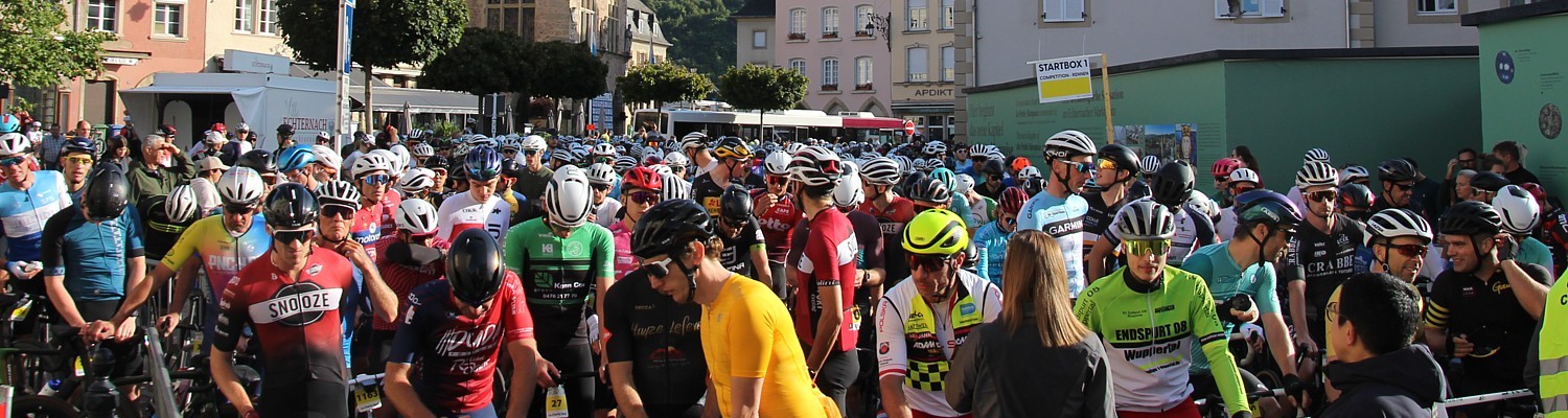
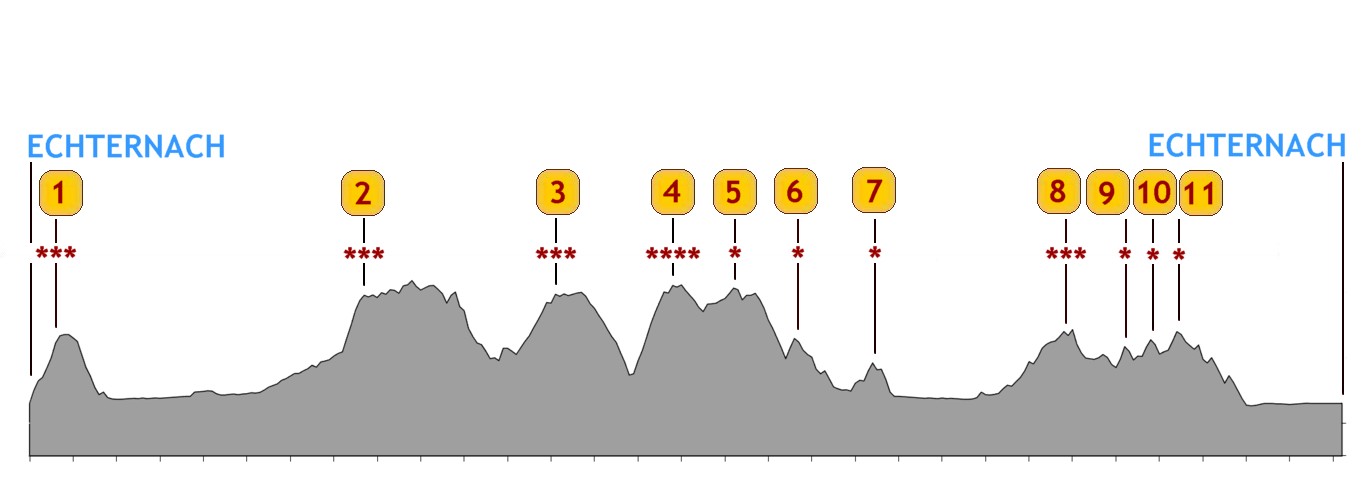
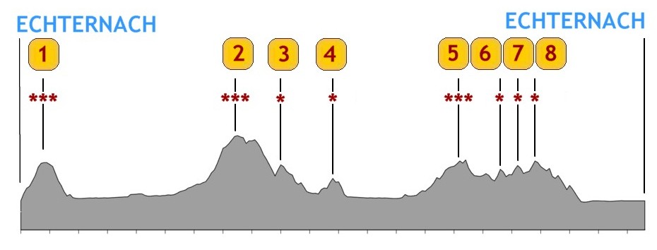
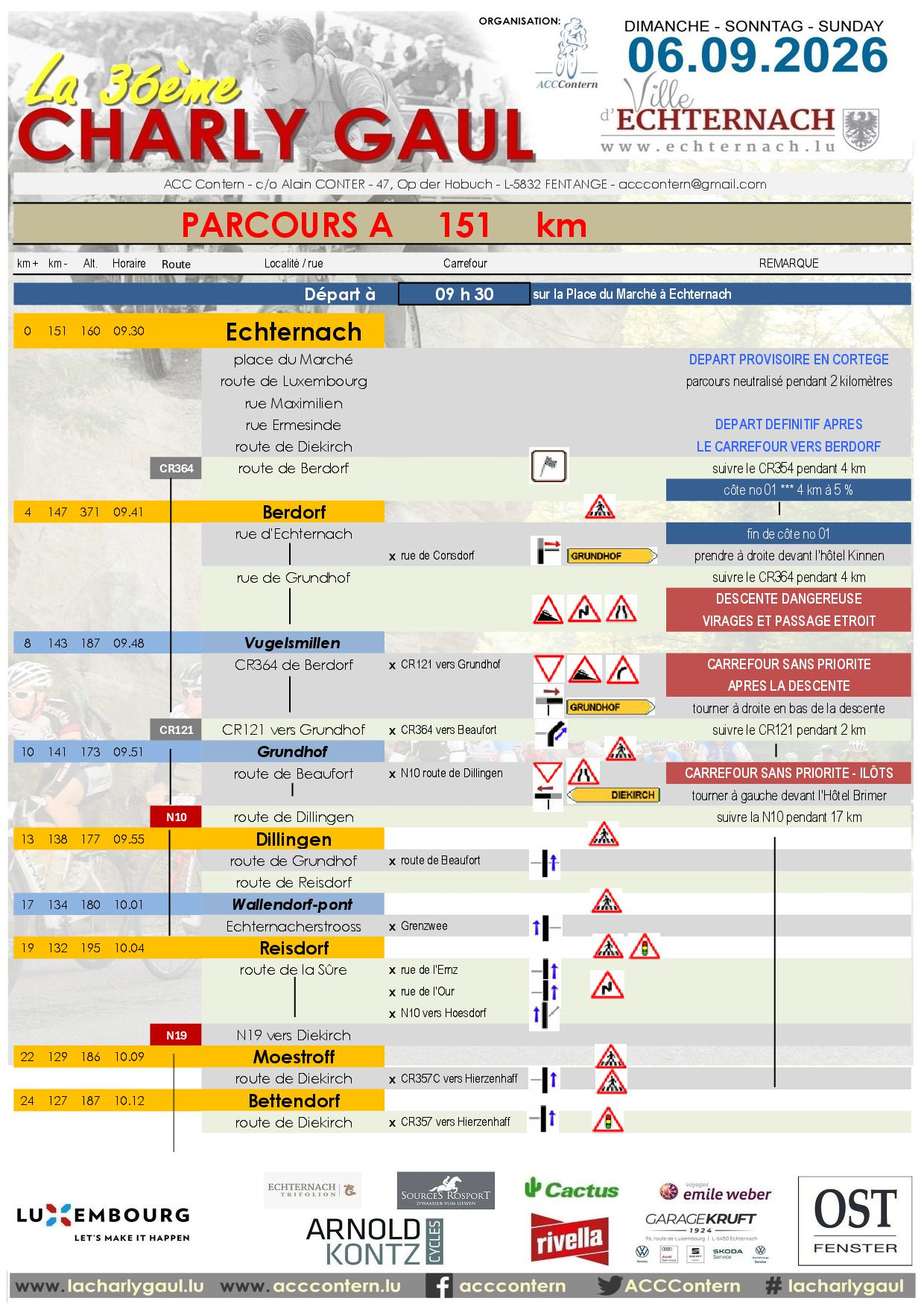
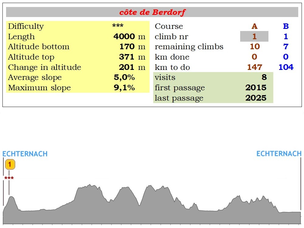
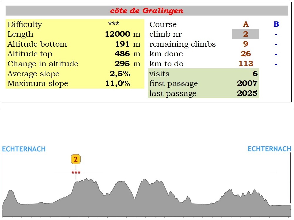
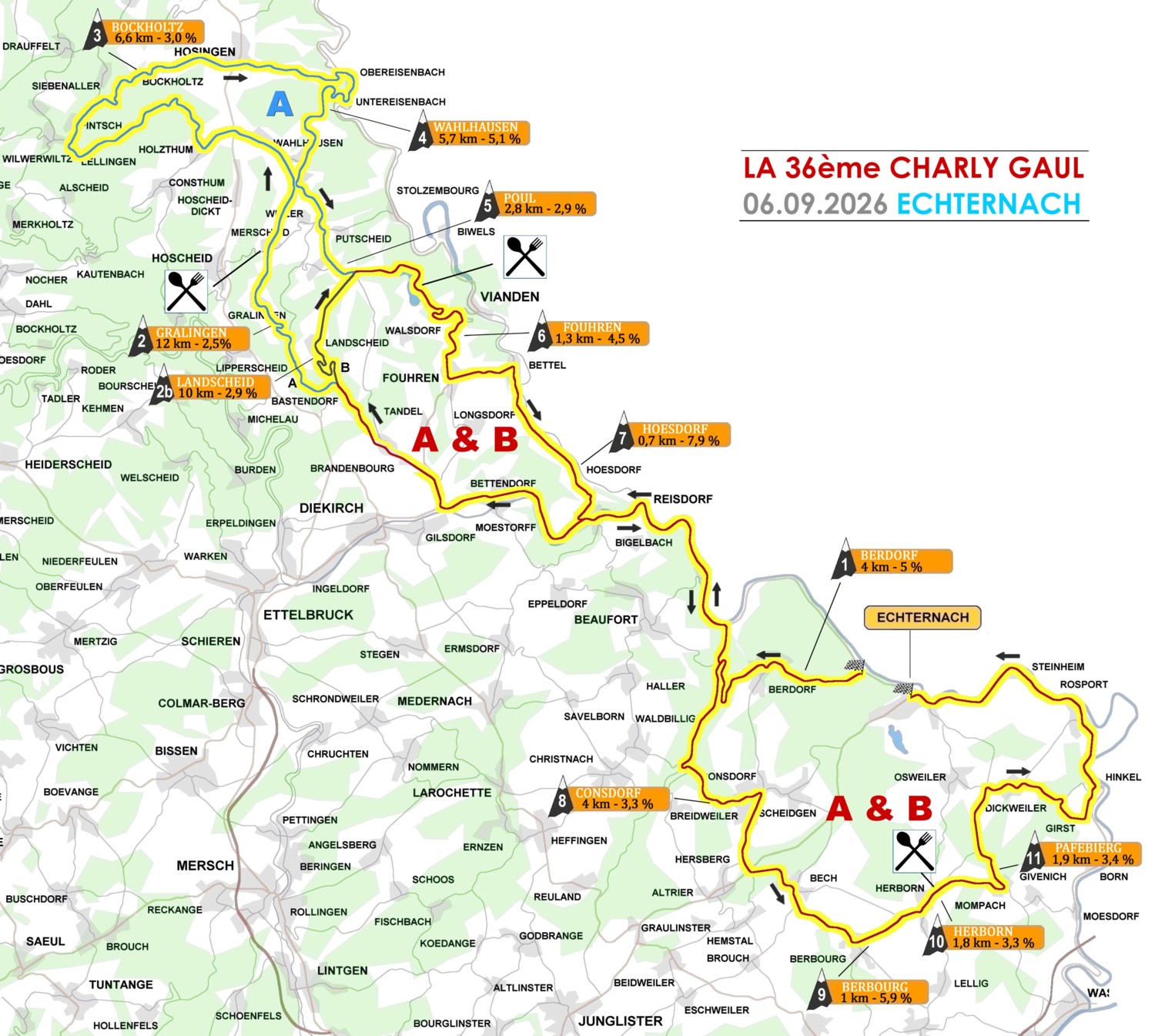
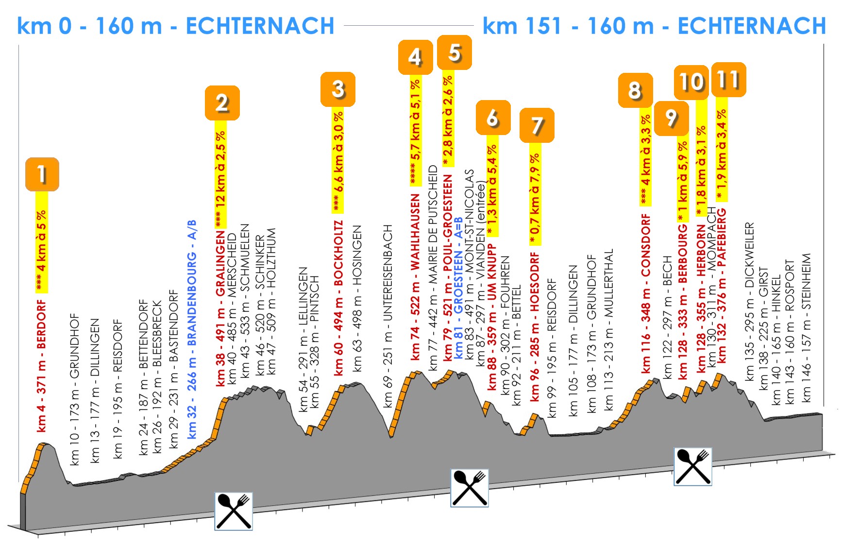
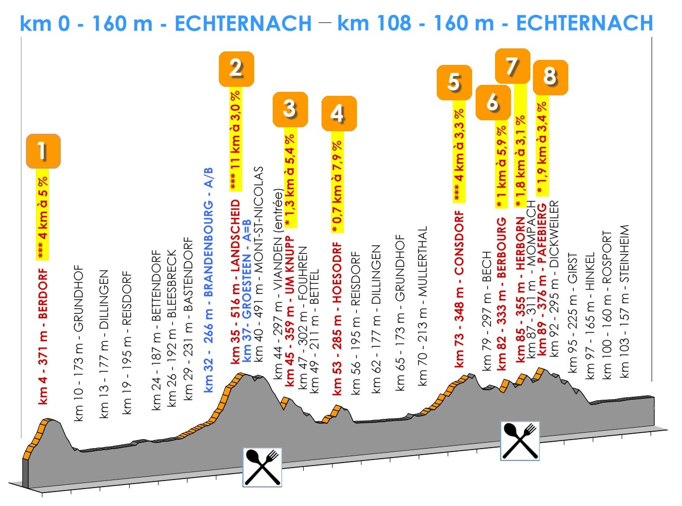
Just like in the past, La Charly Gaul 2026 offers two courses to the participants, with a common start. The longest loop has a total of 151 kilometers with 11 climbs and about 2.000 meters of change in altitude. The shorter course counts 108 kilometers, containing 8 climbs with a total of around 1.300 meters change in altitude.
Riders have to respect the traffic regulations
|
|
|
|
|
|
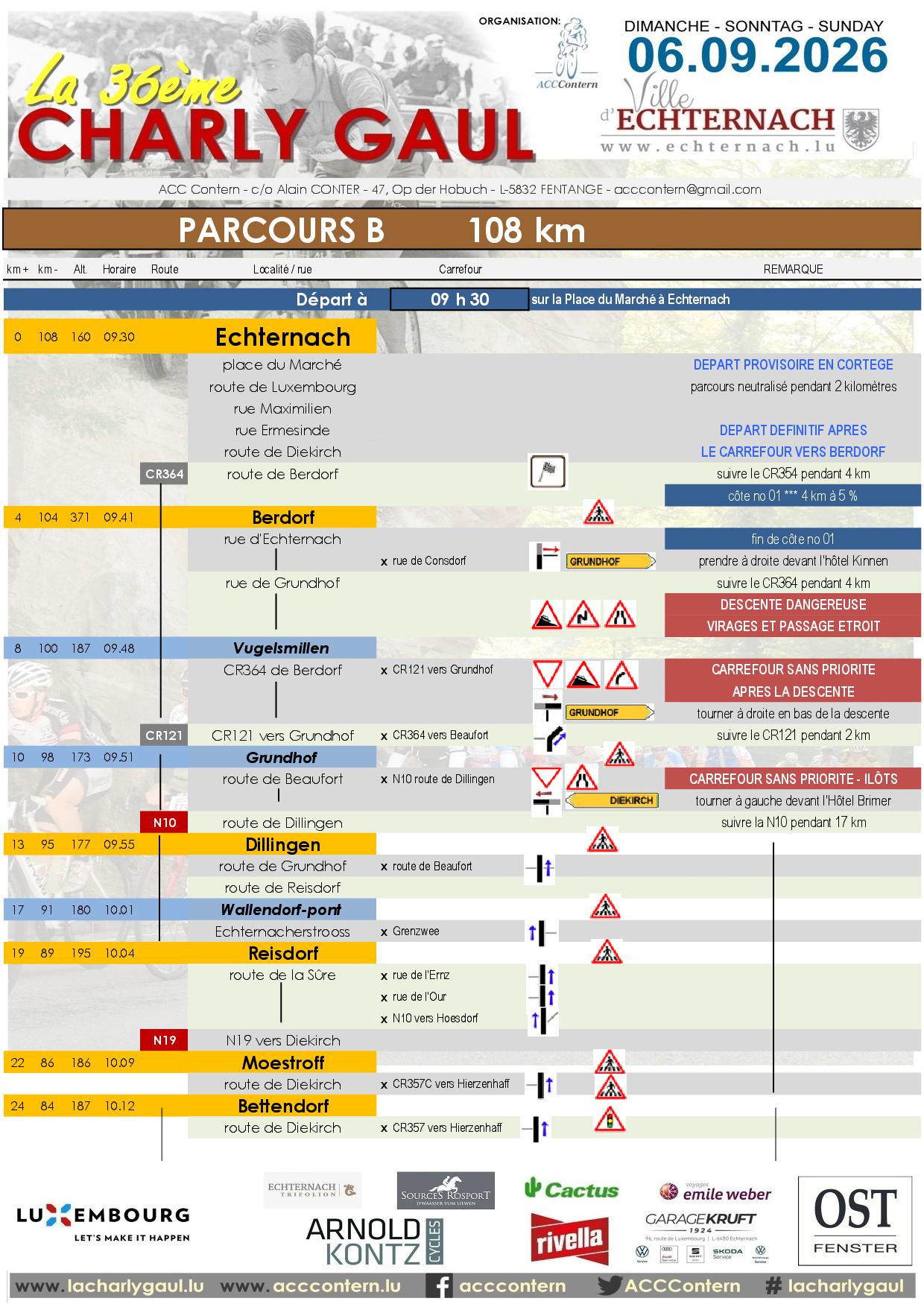
Start at 9h30 on the place du Marché in Echternach
|
|
km +
|
Place
|
Remark
|
Road
|
km -
|
Alt
|

|
|
0
|
ECHTERNACH
|
START
|
CR364
|
151
|
160
|
|
4
|
Berdorf
|
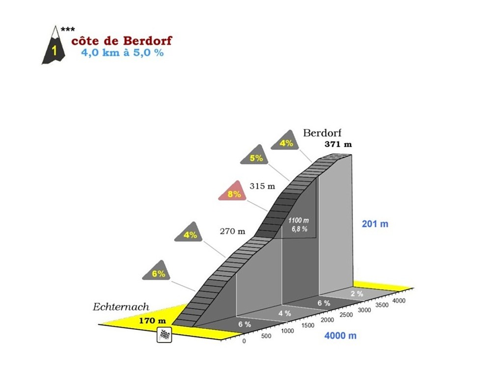
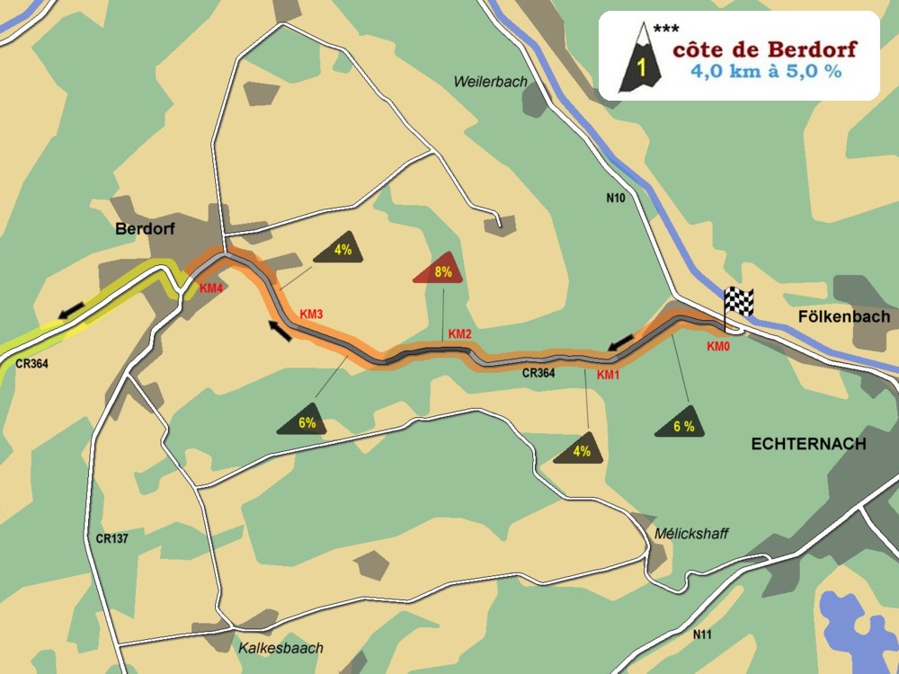
climb 01 *** 4 km - 5%
|
|
|
147
|
371
|
|
8
|
Vugelsmillen
|
|
CR121
|
143
|
187
|
|
10
|
Grundhof
|
|
N10
|
141
|
173
|
|
13
|
Dillingen
|
|
|
|
138
|
177
|
|
19
|
Reisdorf
|
|
N19
|
132
|
195
|
|
22
|
Moestroff
|
|
|
|
129
|
186
|
|
24
|
Bettendorf
|
|
|
|
127
|
187
|
|
26
|
Bleesbreck
|
|
N17
|
125
|
192
|
|
27
|
Seltz
|
|
CR353
|
124
|
201
|
|
29
|
Bastendorf
|
|
|
|
122
|
201
|
|
32
|
Brandenbourg
|
SEPARATION A/B
|
|
|
119
|
266
|
|
38
|
Gralingen
|
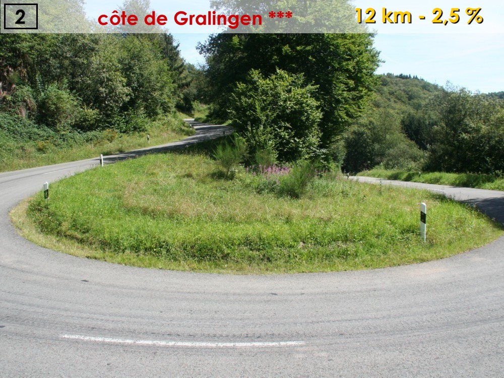
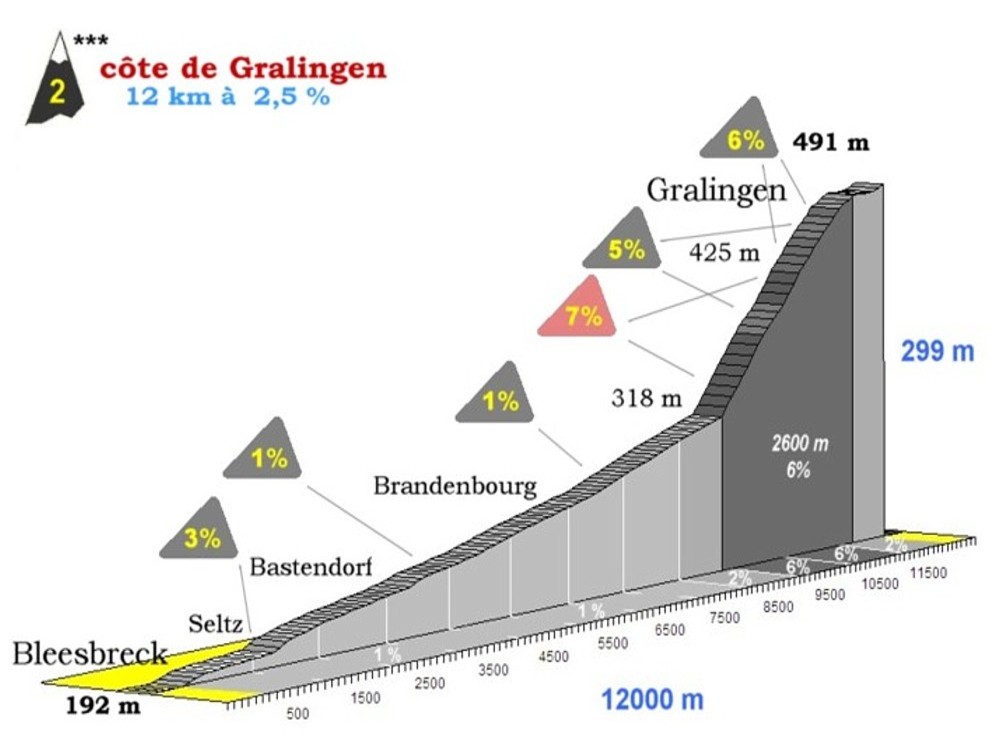
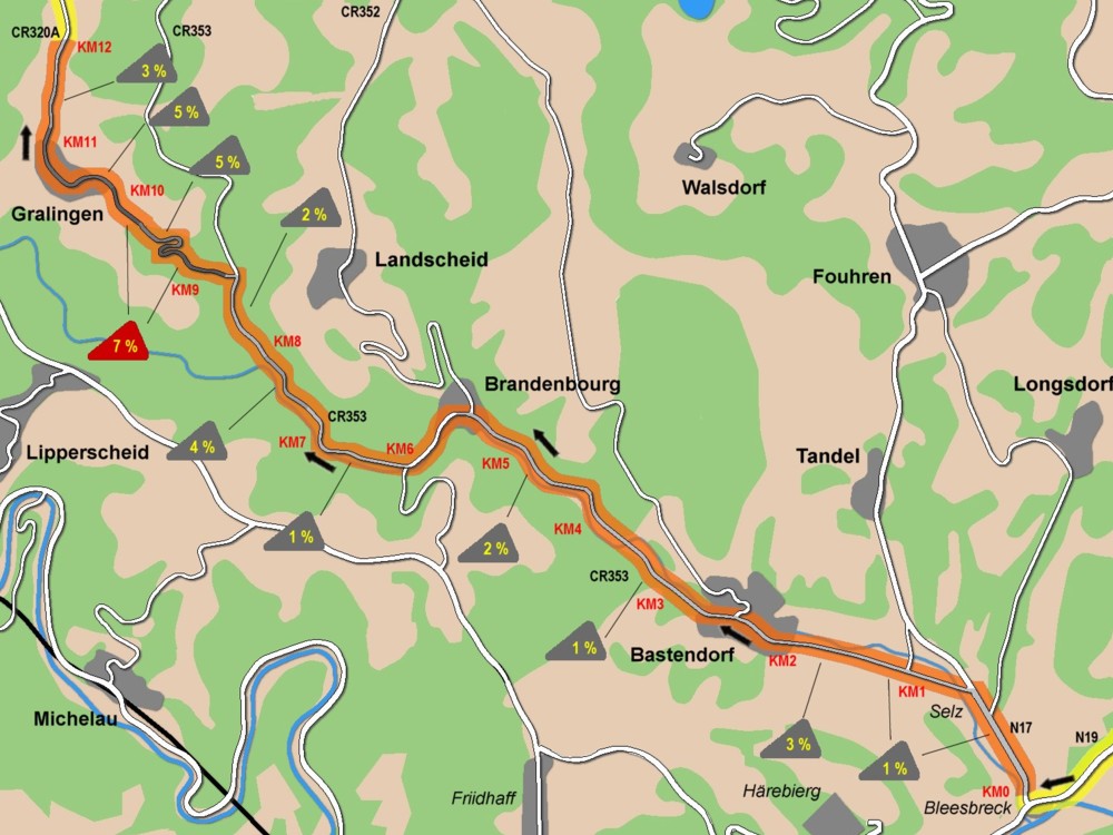
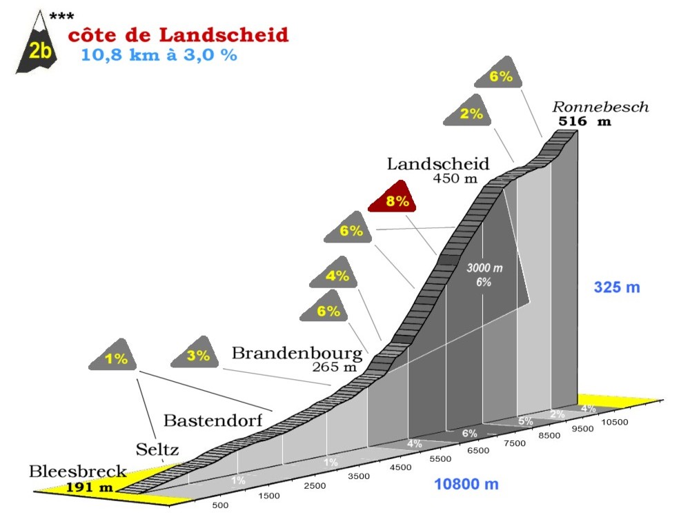
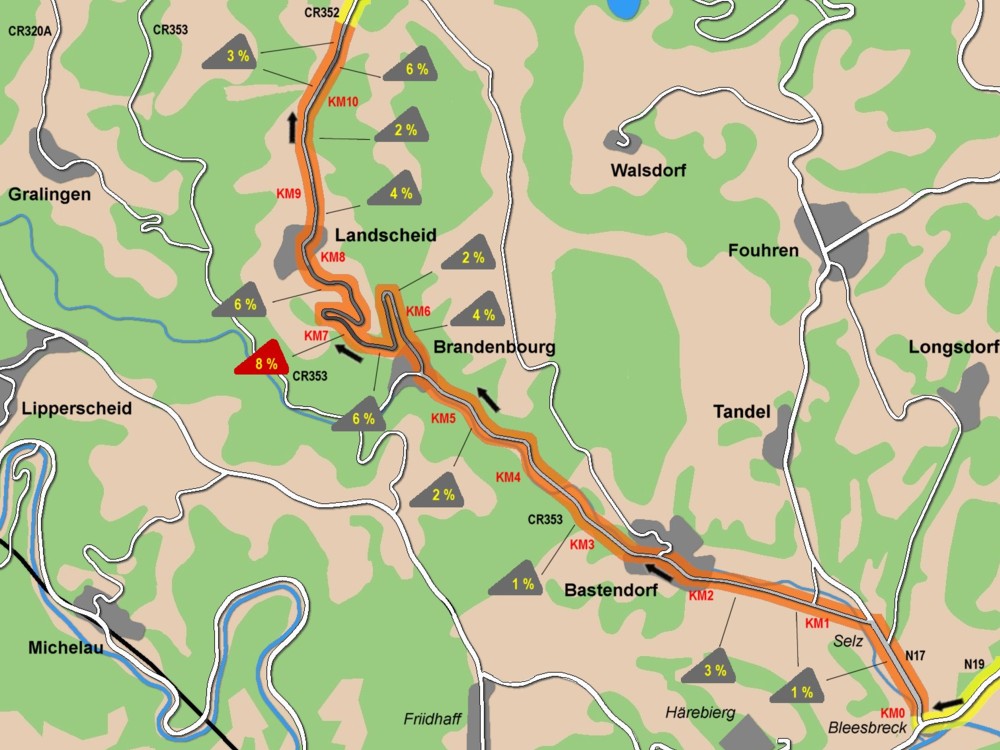
climb 02 *** 12 km - 2,5%
|
CR320a
|
113
|
491
|
|
40
|
Merscheid
|
FOOD ZONE
|
|
111
|
485
|
|
44
|
Wahlhausen (entrance)
|
|
CR322
|
107
|
533
|
|
46
|
Schinker
|
|
|
|
105
|
520
|
|
47
|
Holzthum
|
|
PC22
|
104
|
509
|
|
54
|
Lellingen
|
CR324
|
97
|
291
|
|
55
|
Pintsch
|
|
|
|
96
|
328
|
|
60
|
Bockholtz
|
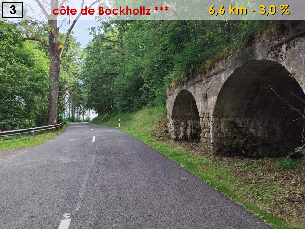
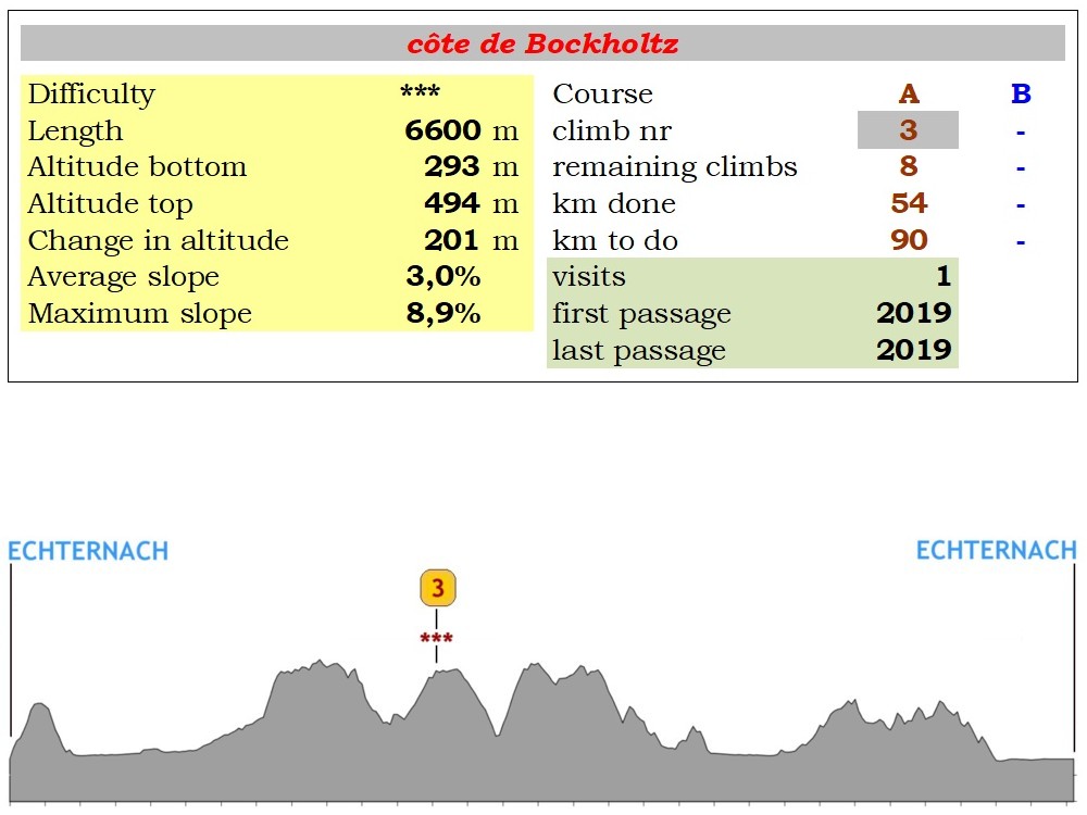
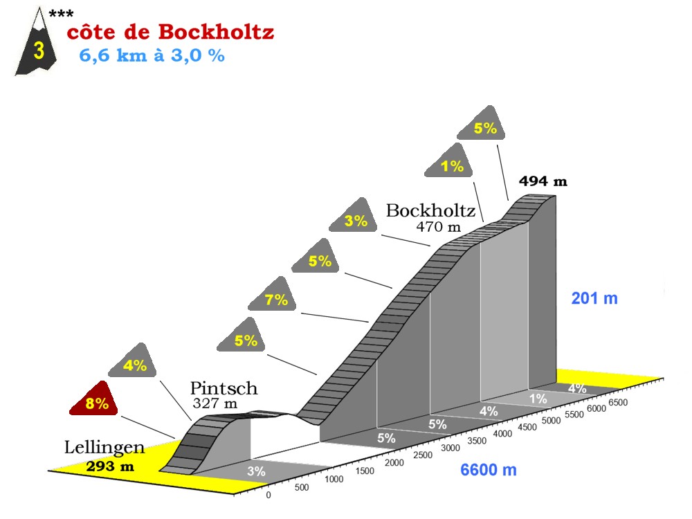
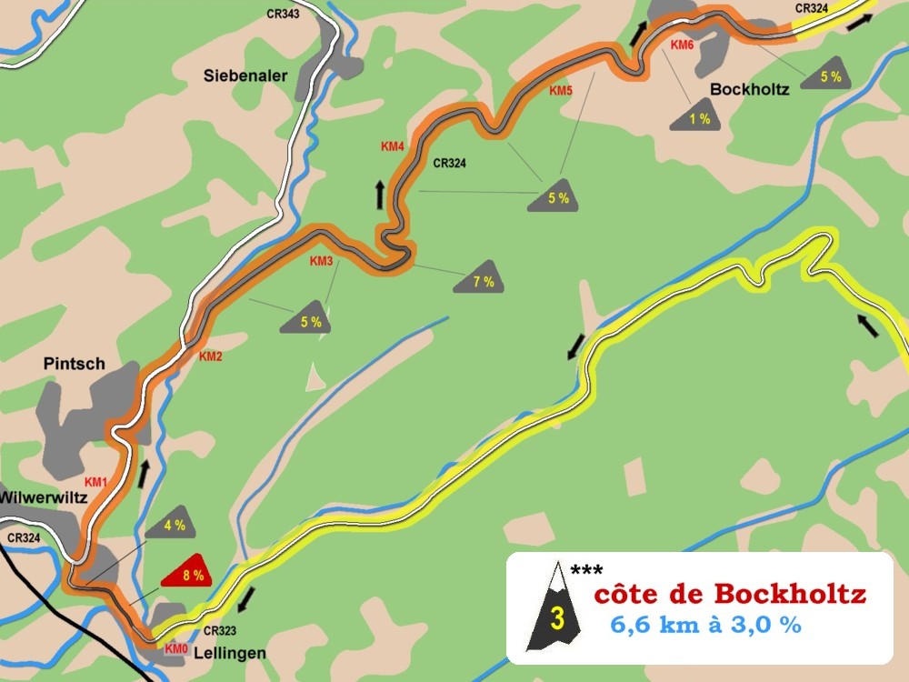
climb 03 *** 6,6 km - 3,0 %
|
|
|
91
|
467
|
|
63
|
Hosingen
|
|
|
|
88
|
498
|
|
68
|
Obereisenbach
|
|
N10
|
83
|
297
|
|
69
|
Untereisenbach
|
|
|
82
|
251
|
|
74
|
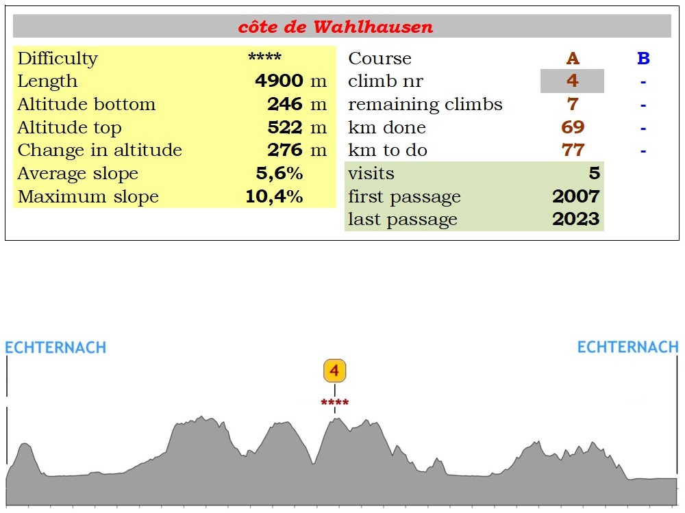
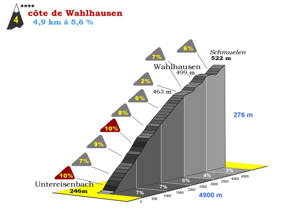
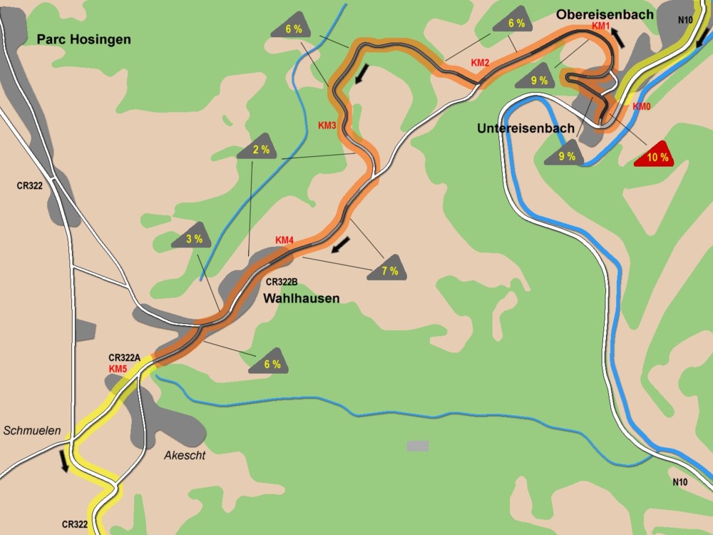
Wahlhausen
|
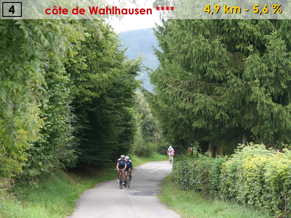
climb 04 **** 5,7 km - 5,1 %
|
CR322a
|
77
|
517
|
|
75
|
Schmuelen
|
|
CR322
|
76
|
533
|
|
77
|
Mairie de Putscheid
|
|
|
|
74
|
442
|
|
79
|
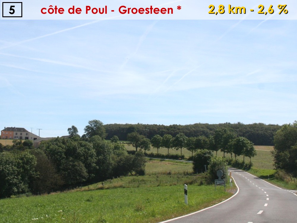
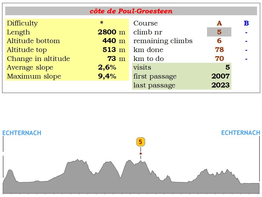
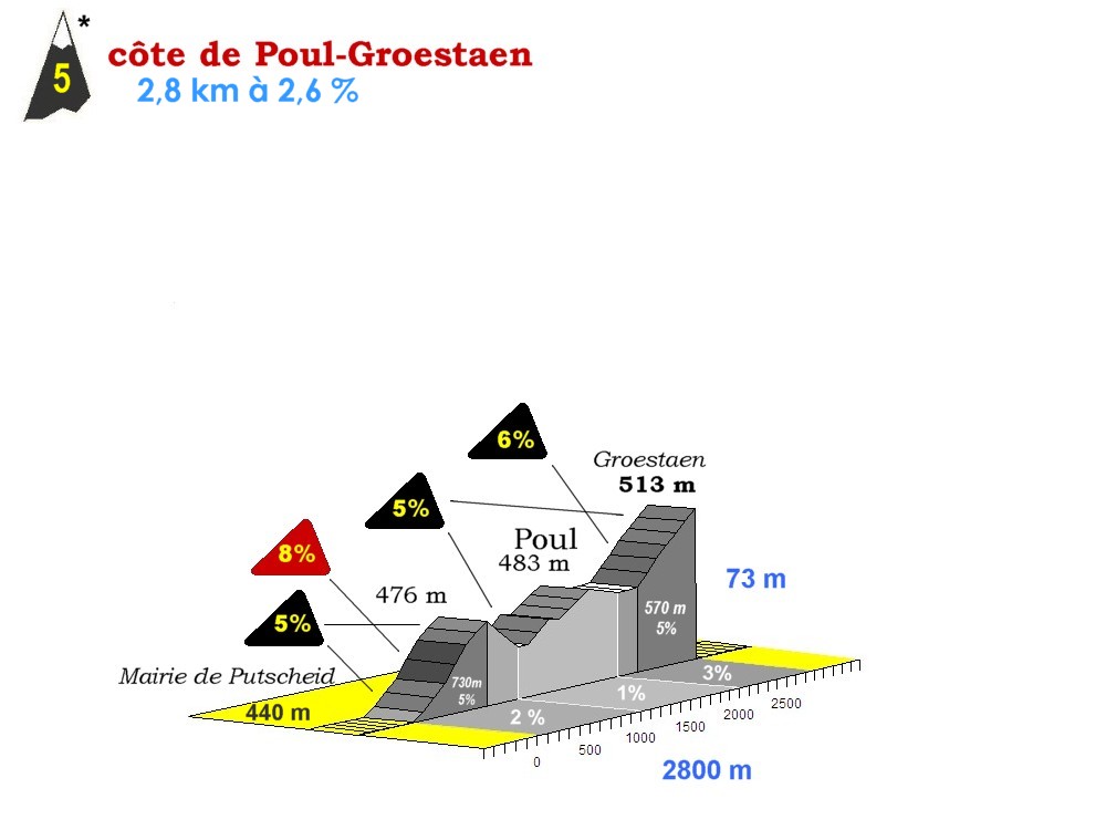
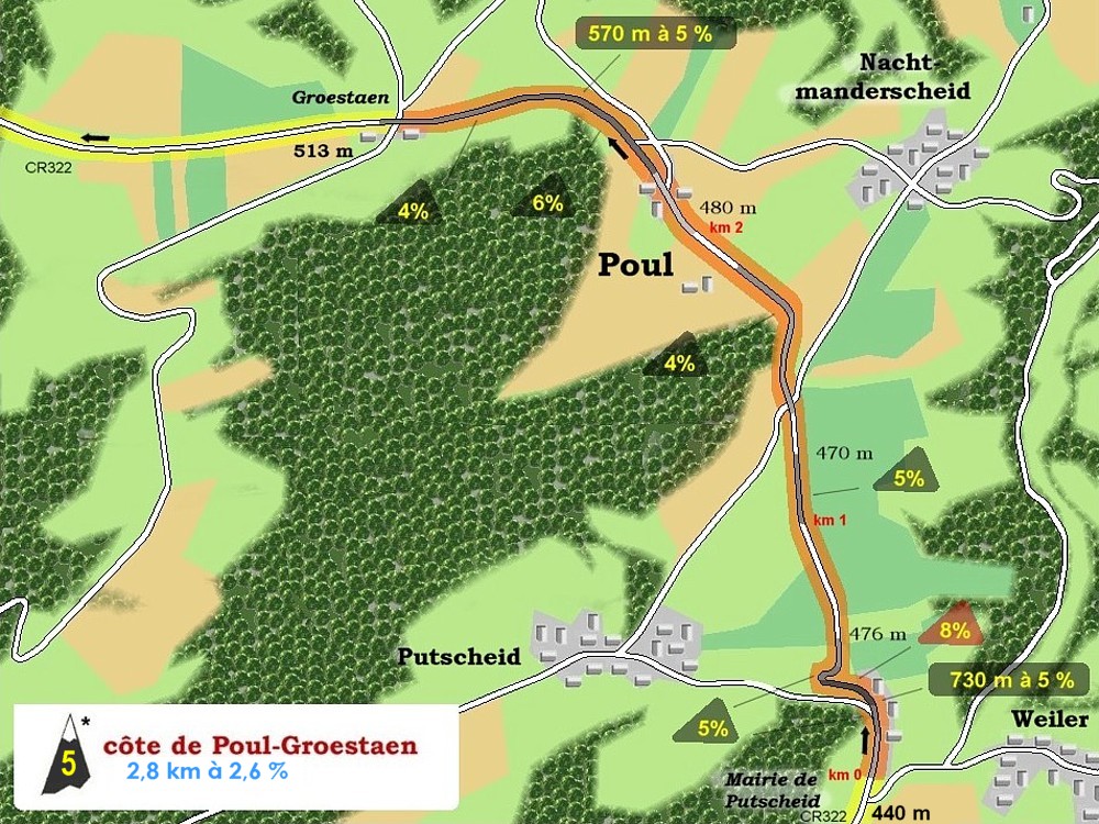
Poul-Groesteen
|
climb 05 * 2,8 km - 2,9 %
|
|
|
72
|
479
|
|
81
|
Groesteen
|
REUNION A=B
|
|
|
70
|
521
|
|
83
|
Mont-St-Nicolas
|
FOOD ZONE
|
|
|
68
|
491
|
|
87
|
Vianden (entrance)
|
|
N17
|
64
|
297
|
|
88
|
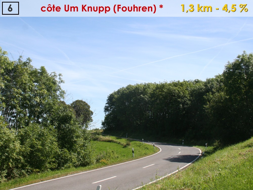
Um Knupp
|
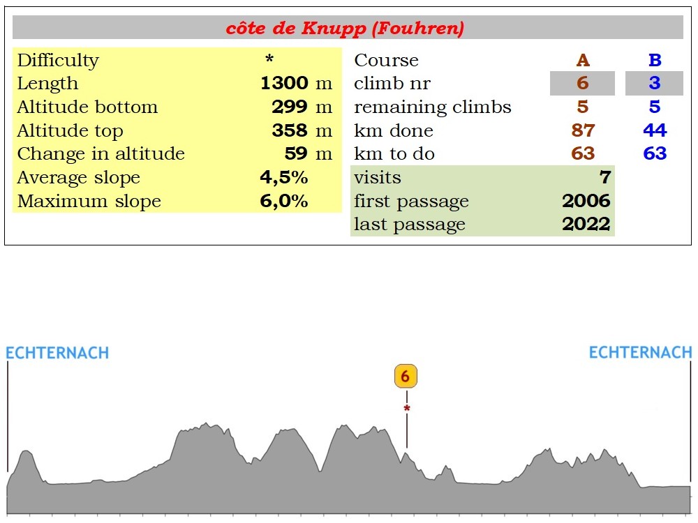
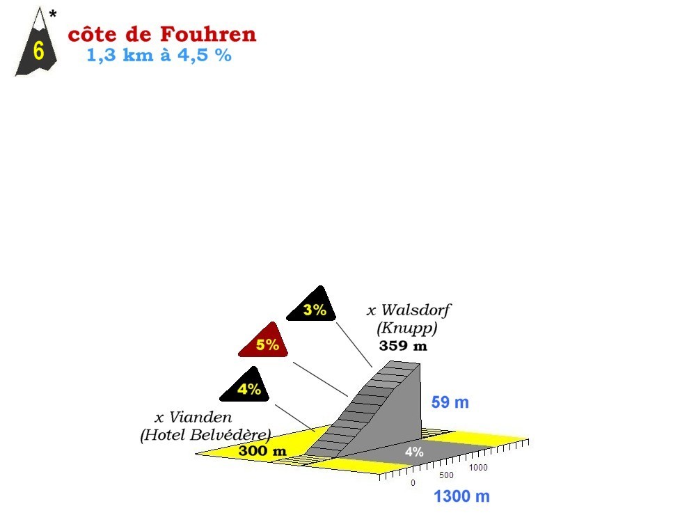
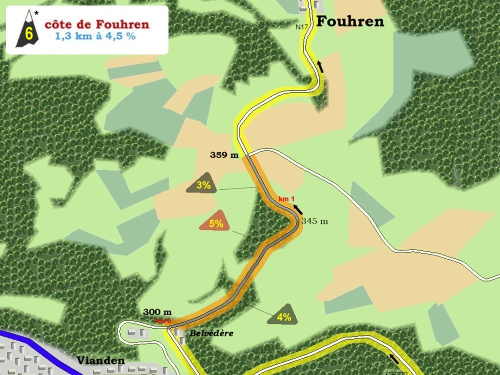
climb 06 * 1,3 km - 4,5 %
|
|
|
63
|
359
|
|
90
|
Fouhren
|
|
N17b
|
61
|
302
|
|
92
|
Bettel
|
|
N10
|
59
|
211
|
|
96
|
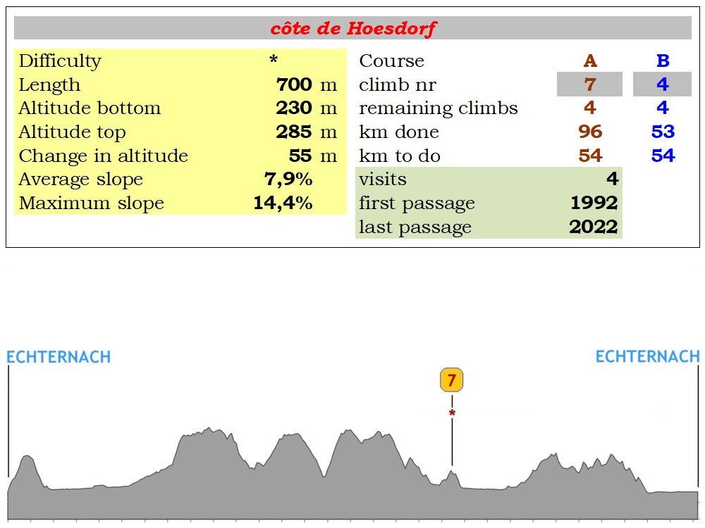
Hoesdorf
|
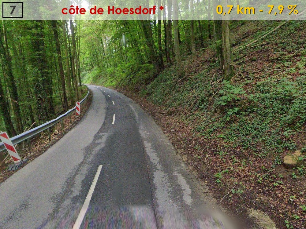
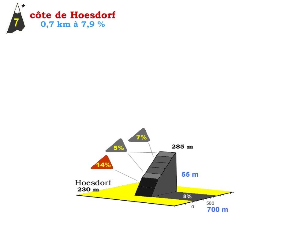
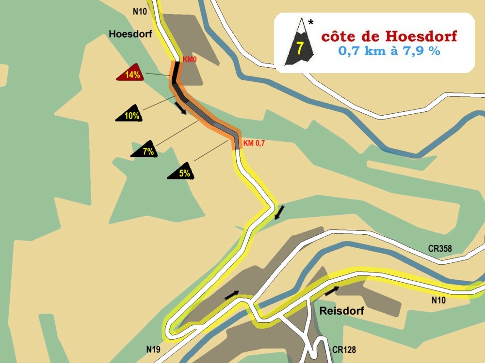
climb 07 * 0,7 km - 7,9 %
|
|
|
55
|
229
|
|
99
|
Reisdorf
|
|
|
|
52
|
195
|
|
105
|
Dillingen
|
|
|
|
46
|
177
|
|
108
|
Grundhof
|
|
CR121
|
43
|
173
|
|
110
|
Vugelsmillen
|
|
|
|
41
|
187
|
|
113
|
Mullerthal
|
|
CR356
|
38
|
213
|
|
116
|
Consdorf
|
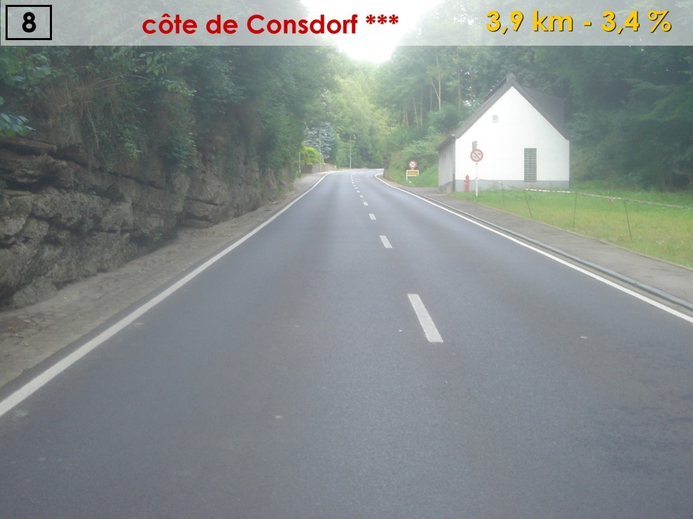
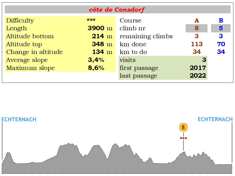
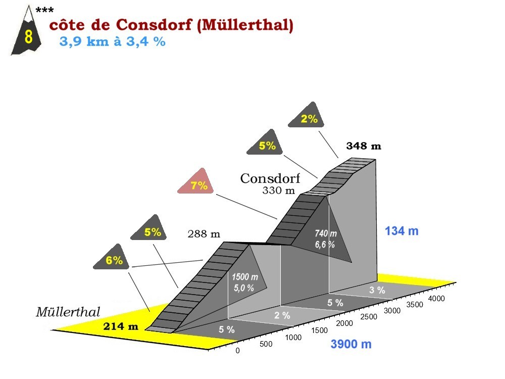
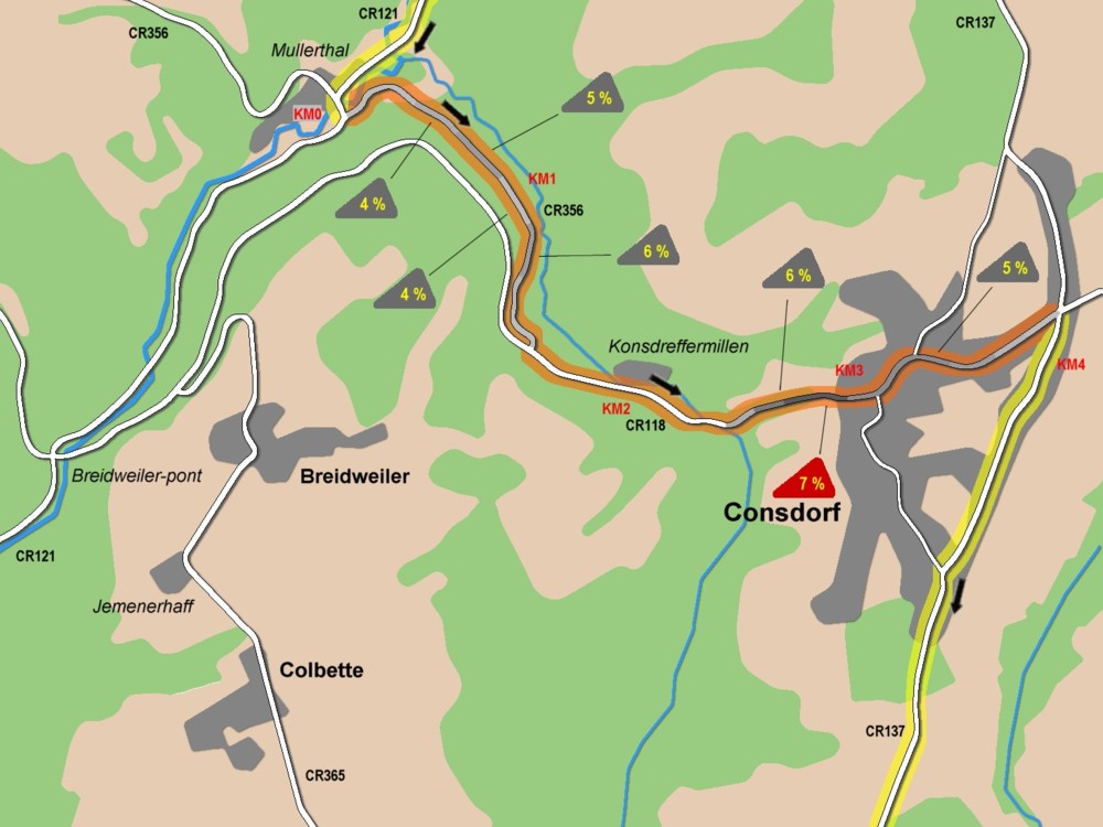
climb 08 *** 4 km - 3,3 %
|
CR137
|
35
|
329
|
|
122
|
Bech
|
|
|
|
29
|
297
|
|
125
|
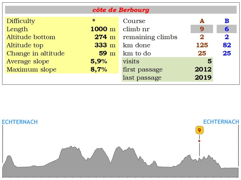
Berbourg
|
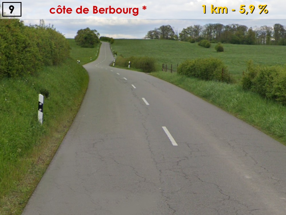
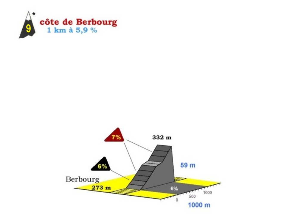
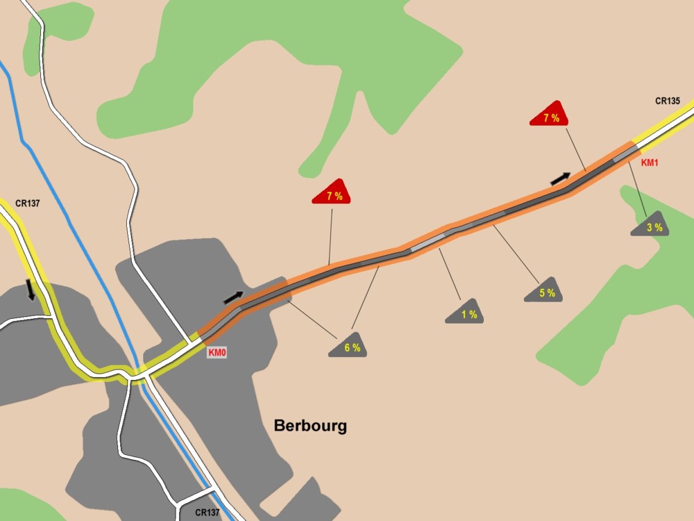
climb 09 * 1 km - 5,9%
|
CR135
|
26
|
273
|
|
128
|
Herborn
|
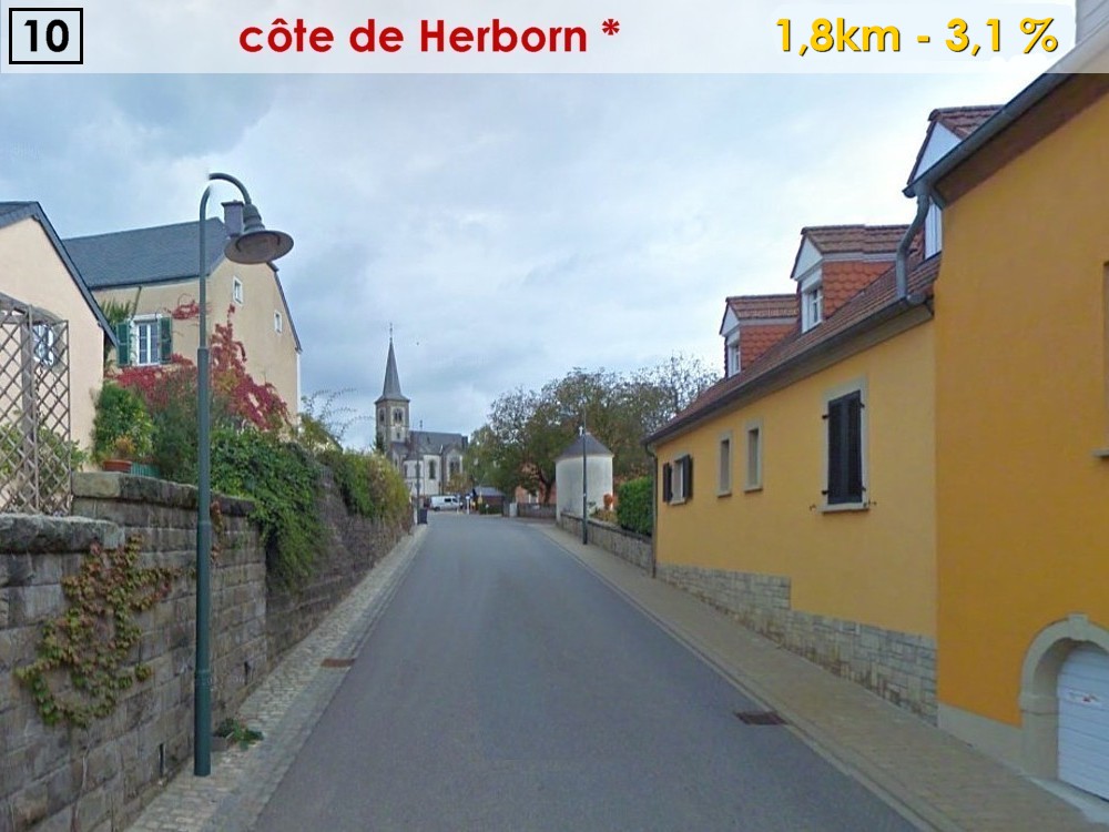
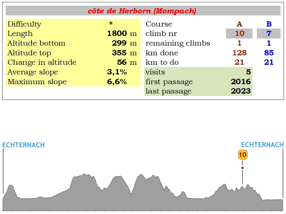
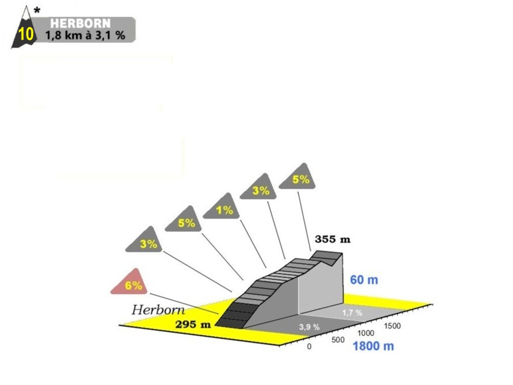
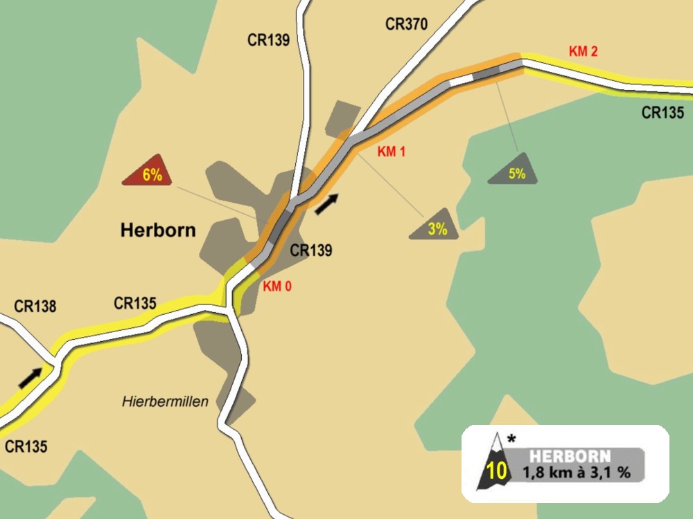
climb 10 * 3,4 km - 2%
|
|
|
23
|
304
|
|
|
|
FOOD ZONE
|
|
|
|
|
130
|
Mompach
|
|
CR141
|
21
|
311
|
|
132
|
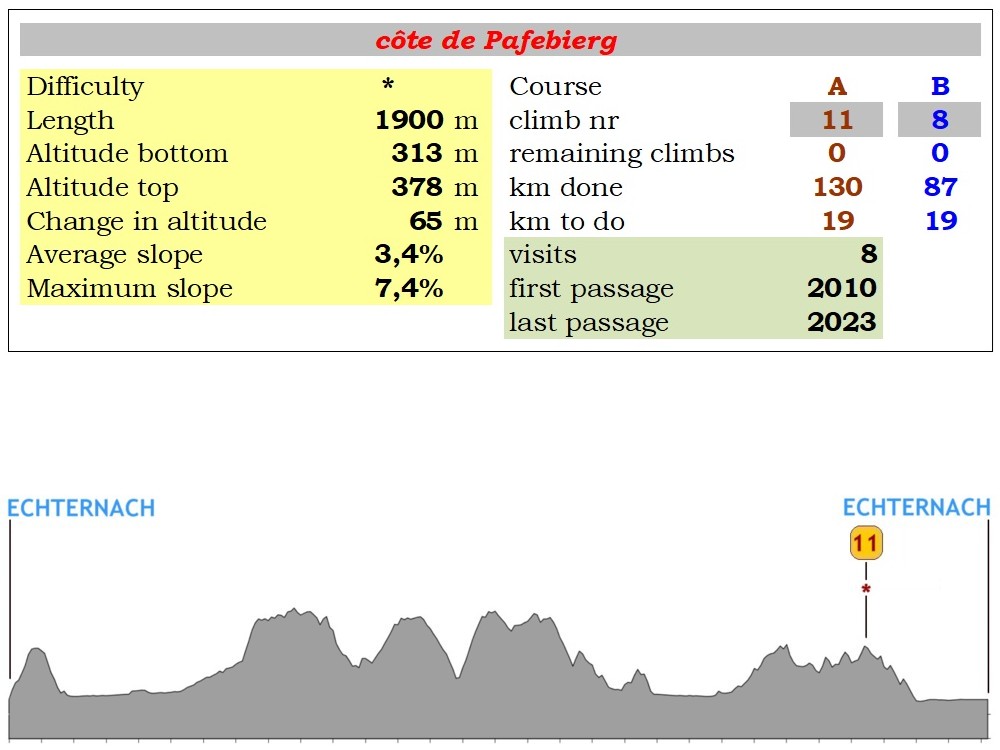
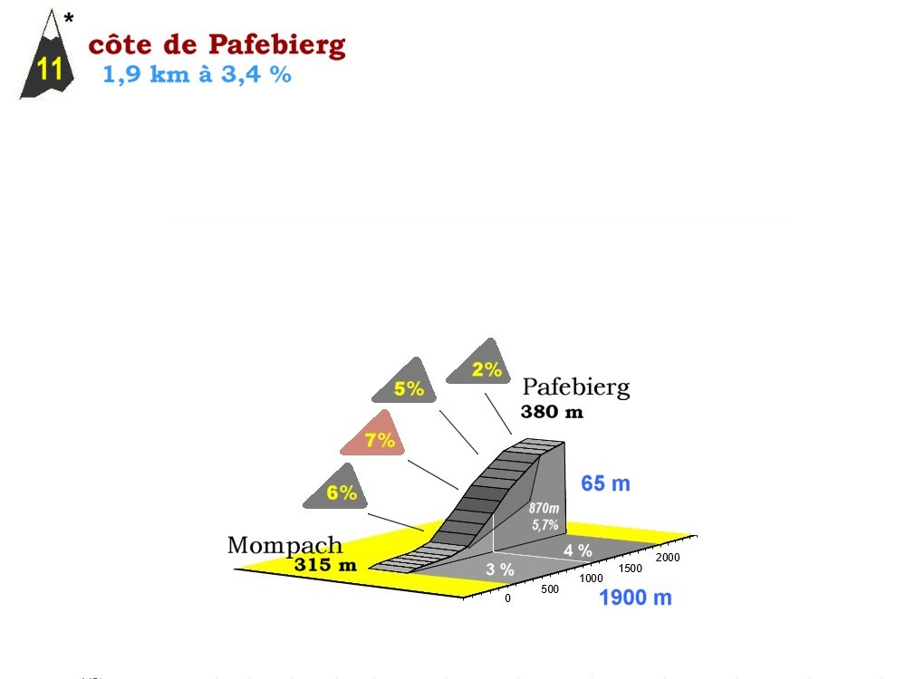
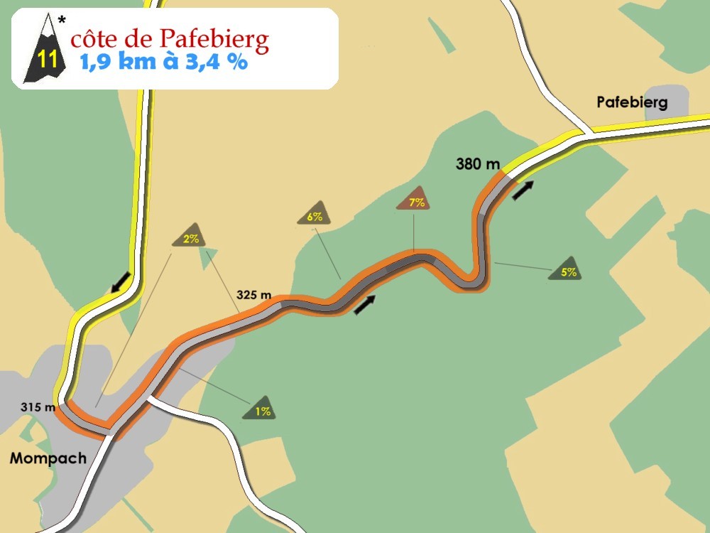
Pafebierg
|
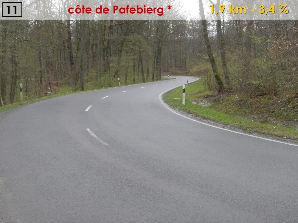
climb 11 * 1,9 km - 3,4%
|
|
|
19
|
376
|
|
134
|
intersection Osweiler
|
|
CR370
|
17
|
337
|
|
135
|
Dickweiler
|
|
CR370
|
16
|
295
|
|
138
|
Girst
|
|
|
|
13
|
225
|
|
140
|
Hinkel
|
|
PC3
|
11
|
165
|
|
143
|
Rosport
|
|
N10
|
8
|
160
|
|
146
|
Steinheim
|
|
|
|
5
|
157
|
|
151
|
ECHTERNACH
|
FINISH
|
|
|
0
|
160
|
|
|
|
TOTAL CHANGE IN ALTITUDE: 1.989 m
|
|
|
|
|
|
|
|
|
|
|
|
|
|
|
|
|
|
|
|
|
|
Start at 9h30 on the place du Marché in Echternach
|
|
km +
|
Place
|
Remark
|
Road
|
km -
|
Alt
|
|
|
|
0
|
ECHTERNACH
|
START
|
CR364
|
108
|
160
|
|
4
|
Berdorf
|
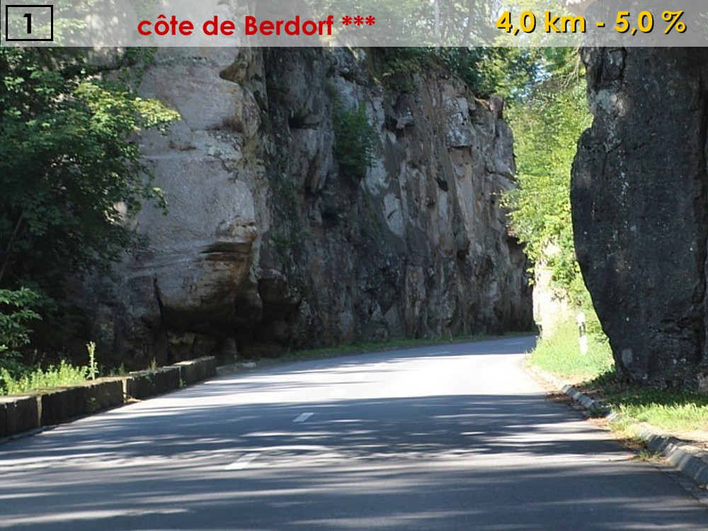
climb 01 *** 4 km - 5%
|
|
|
104
|
371
|
|
8
|
Vugelsmillen
|
|
CR121
|
100
|
187
|
|
10
|
Grundhof
|
|
N10
|
98
|
173
|
|
13
|
Dillingen
|
|
|
|
95
|
177
|
|
19
|
Reisdorf
|
|
N19
|
89
|
195
|
|
22
|
Moestroff
|
|
|
|
86
|
186
|
|
24
|
Bettendorf
|
|
|
|
84
|
187
|
|
26
|
Bleesbreck
|
|
N17
|
82
|
192
|
|
27
|
Seltz
|
|
CR353
|
81
|
201
|
|
29
|
Bastendorf
|
|
|
|
79
|
201
|
|
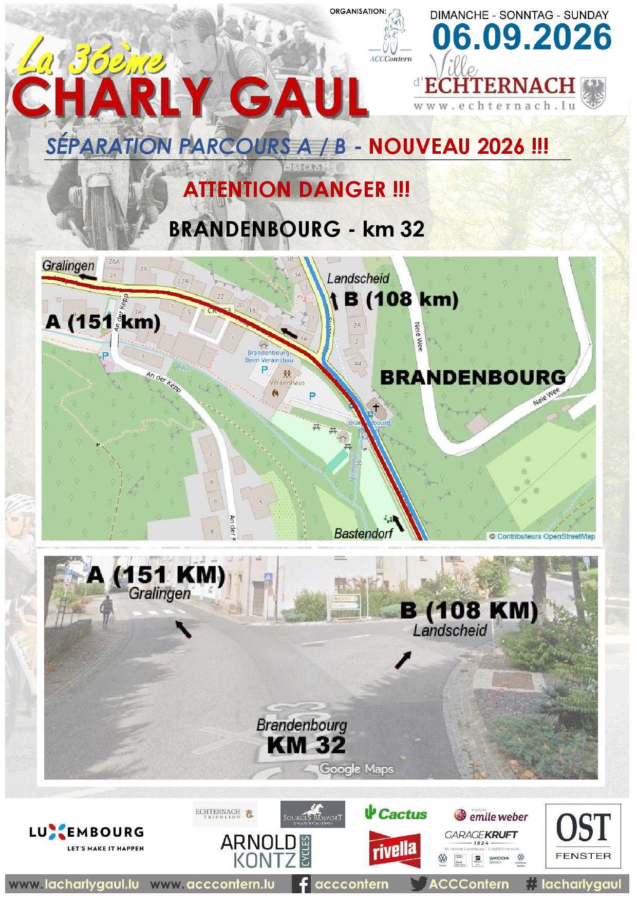
32
|
Brandenbourg
|
SEPARATION A/B
|
|
|
76
|
266
|
|
35
|
Landscheid
|
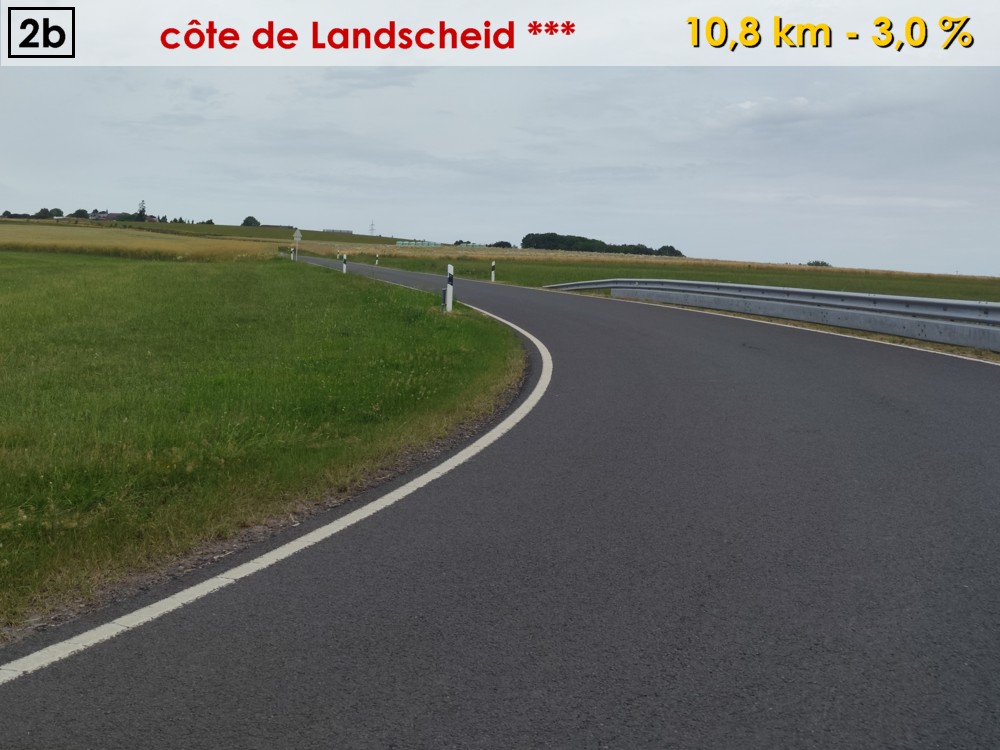
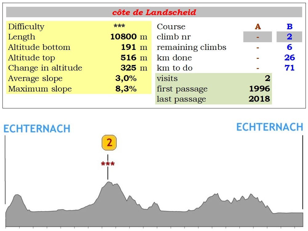
climb 02 *** 10 km - 2,9%
|
CR320a
|
73
|
454
|
|
32
|
Groesteen
|
REUNION A=B
|
|
|
70
|
521
|
|
40
|
Mont-St-Nicolas
|
FOOD ZONE
|
|
|
68
|
491
|
|
44
|
Vianden (entrance)
|
|
N17
|
64
|
297
|
|
45
|
Um Knupp
|
climb 03 * 1,3 km - 4,5 %
|
|
|
63
|
359
|
|
47
|
Fouhren
|
|
N17b
|
61
|
302
|
|
49
|
Bettel
|
|
N10
|
59
|
211
|
|
53
|
Hoesdorf
|
climb 04 * 0,7 km - 7,9 %
|
|
|
55
|
229
|
|
56
|
Reisdorf
|
|
|
|
52
|
195
|
|
62
|
Dillingen
|
|
|
|
46
|
177
|
|
65
|
Grundhof
|
|
CR121
|
43
|
173
|
|
67
|
Vugelsmillen
|
|
|
|
41
|
187
|
|
70
|
Mullerthal
|
|
CR356
|
38
|
213
|
|
73
|
Consdorf
|
climb 05 *** 4 km - 3,3 %
|
CR137
|
35
|
329
|
|
79
|
Bech
|
|
|
|
29
|
297
|
|
82
|
Berbourg
|
climb 06 * 1 km - 5,9%
|
CR135
|
26
|
273
|
|
85
|
Herborn
|
climb 07 * 3,4 km - 2%
|
|
|
23
|
304
|
|
|
|
FOOD ZONE
|
|
|
|
|
87
|
Mompach
|
|
CR141
|
21
|
311
|
|
89
|
Pafebierg
|
climb 08 * 1,9 km - 3,4%
|
|
|
19
|
376
|
|
91
|
intersection Osweiler
|
|
CR370
|
17
|
337
|
|
92
|
Dickweiler
|
|
CR370
|
16
|
295
|
|
95
|
Girst
|
|
|
|
13
|
225
|
|
97
|
Hinkel
|
|
PC3
|
11
|
165
|
|
100
|
Rosport
|
|
N10
|
8
|
160
|
|
103
|
Steinheim
|
|
|
|
5
|
157
|
|
108
|
ECHTERNACH
|
FINISH
|
|
|
0
|
160
|
|
|
|
TOTAL CHANGE IN ALTITUDE: 1.290 m
|
|
|
|
|
|
|
|
|
|
|
|
|
|
|
|
|
|
You can download here the detailed routes for the two courses of La Charly Gaul 2025, as printable .pdf documents or as .kml and .gpx files, to be used in your navigation systems..
|
You need Adobe Acrobat Reader to read these documents. If you don't have this software, you can download it HERE and install it on your computer.
OVERALL MAP
DETAILED MAP A - 151 km (map.geoportail.lu)
DETAILED MAP B - 108 km (map.geoportail.lu)
ATTENTION DANGER !!!
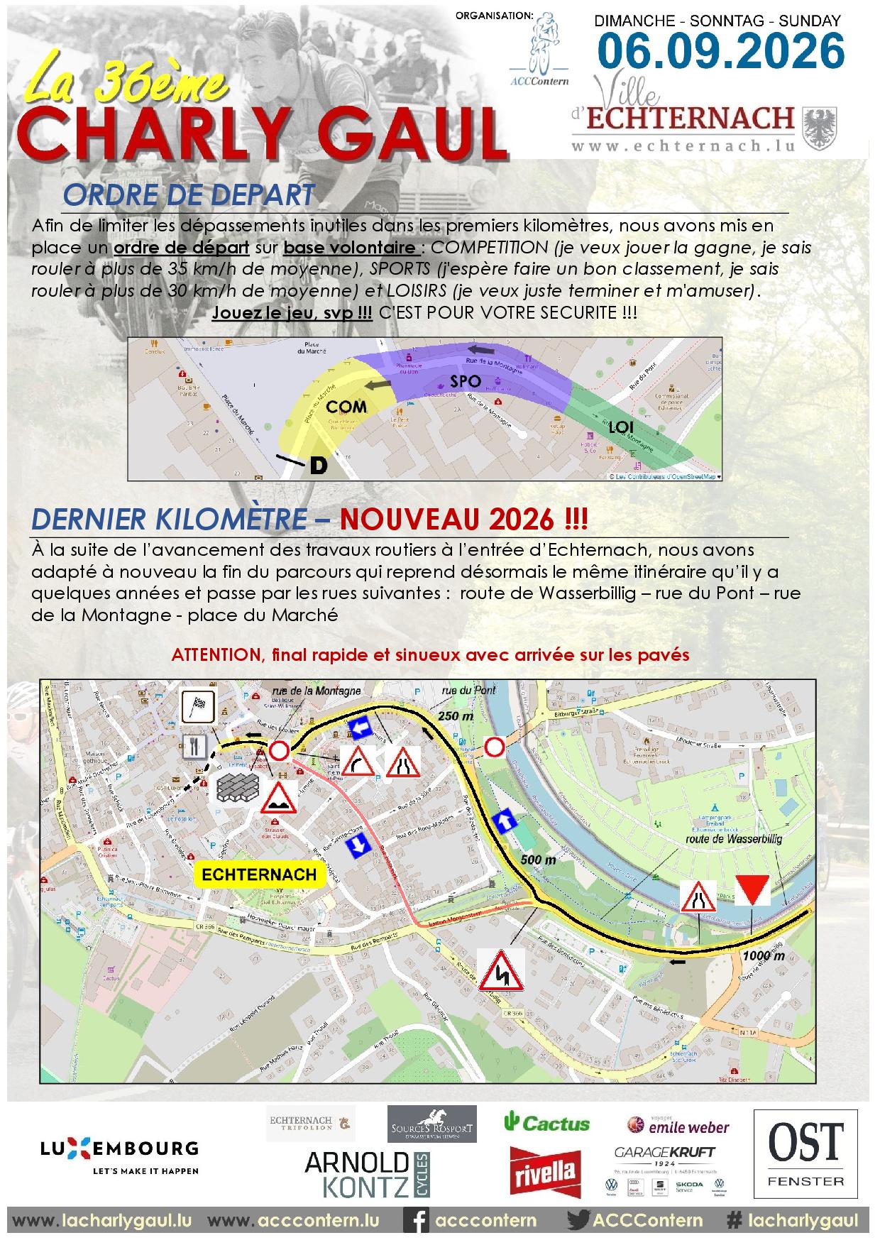
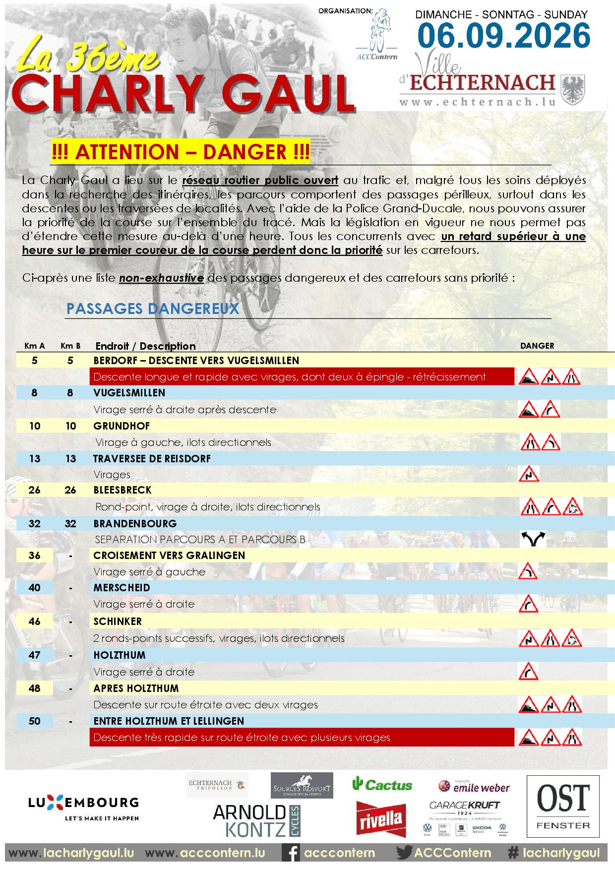
La Charly Gaul takes place on public roads that are open to other traffic and it is unfortunately not possible to design a course without a few dangerous passages, especially on the downhills and in villages or towns. Due to the very precious help of the Luxemburgish police, we are able to guarantee priority to the participants of La Charly Gaul on the entire course of the race. However, the law doesn’t enable us to maintain this priority for more than an hour. As a consequence each participant who is more than one hour late on the first rider of the race loses the priority on the course.
You can download hereafter a non-exhaustive list with the most dangerous points and intersections on the course:
(as .pdf document).
|
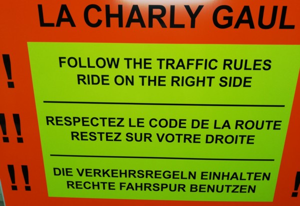
For your own safety, PLEASE STAY ON YOUR RIGHT!
PLEASE RESPECT THE TRAFFIC REGULATIONS
We also want you to be aware of bycicle thefts that are more and more common in our country since several years.
BE CAREFULL AND KEEP YOUR EYES ON YOUR BIKE !!!
PROFILE COURSE A (151 km)
PROFILE COURSE B (108 km)
You can find hereafter some detailed informations about the climbs of La 36ème Charly Gaul:
|
côte de Herborn (Mompach)
|
Note: "This site contains links to other pages, on which content and presentation we don't have any influence. These refences are indicated merely for your information and and we can't be made reliable for any of the content of any of the places our links may take you to."
Contact: ACC Contern - c/o M. Alain Conter - 47, Op der Hobuch - L-5832 Fentange - acccontern@gmail.com
|
|